Hello team,
I’ve been testing OpenMAINT installations (different versions, multiple instances) and I keep running into the same issue:
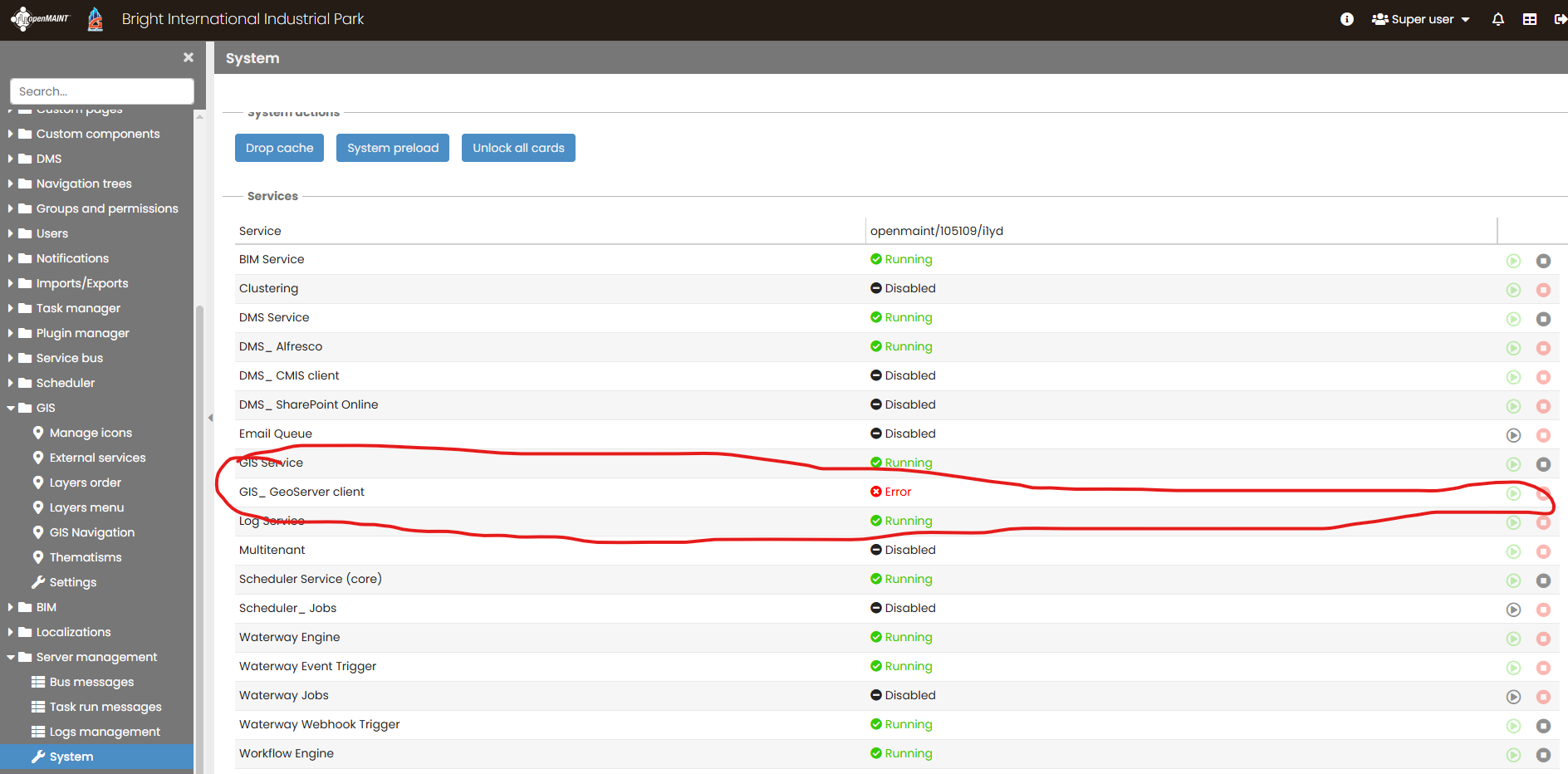
GIS_ GeoServer client = Error
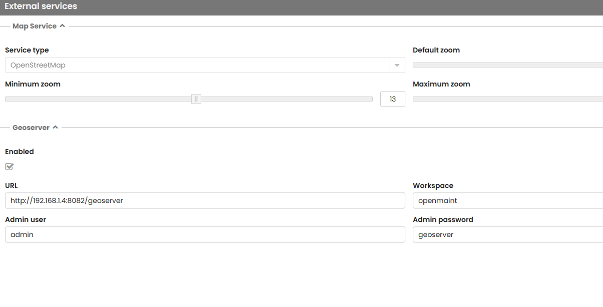
Here’s my setup:
- I have GeoServer running at
http://localhost:8082/geoserver. - I successfully imported a GeoTIFF file into GeoServer, and it displays correctly when accessed directly.
My goal is to overlay this GeoTIFF on top of the main map in OpenMAINT.
However, every attempt to connect OpenMAINT to GeoServer results in the error above.
Questions:
- Is there a specific configuration I need in
openmaintorGeoServer(workspace, store, or WMS settings) to get the map overlay working? - Do I need to modify the default OpenMAINT GIS settings (for example, pointing to a WMS URL like
http://localhost:8082/geoserver/wmsinstead of the GeoServer root)? - Are there version compatibility constraints between OpenMAINT and GeoServer that I should be aware of?
Any guidance or examples of a working setup would be very helpful.
Thanks in advance for your support!